Sunday, September 29, 2013

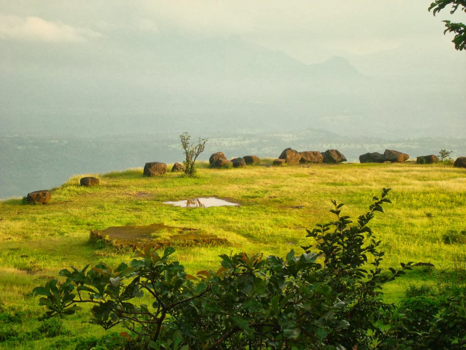
Madhe Ghat, Near Kelad.


Madhe Ghat is an ancient historical route. Shivaji's great worrier Tanaji Malusare died while fighting on Kondana (Sinhagad) fort and his dead body was carried via this route called "Madhe Ghat" to his native village in Konkan. (Also, the work of a proposed road from Pune to Mahad via Madhe Ghat is going on... which will save the distance & time.)
Madhe Ghat is 75kms from Pune, but some distance can be saved by going through Route 2 & 3
How to Reach Madhe Ghat:

Route 1 - Pune - NH4 - Nasrapur Phata - Baneshwar - Velhe - Kelad - Madhe Ghat

Route 2 - Pune - NH4 - Shivapur - Kusgav Khind Road - Velhe - Kelad - Madhe Ghat

Route 3 - Pune - Sinhgad Road - Khanpur - Pabe Ghat - Velhe - Kelad - Madhe Ghat

Route 4 - Pune - Sinhgad Road - Panshet Velhe road - Velhe - Kelad - Madhe Ghat

Best time to visit Madhe Ghat is from August  to November

For more photos see link below
https://www.facebook.com/Weekendtravels.in
Madhe Ghat
Madhe Ghat

Madhe Ghat

Madhe Ghat

Madhe Ghat

Madhe Ghat

Madhe Ghat

Madhe Ghat

Madhe Ghat

Madhe Ghat

Madhe Ghat
 For more photos see link below
 https://www.facebook.com/media/set/?set=a.369639746487180.1073741844.359767254141096&type=1&l=88980712f9


Reaching Madhe Ghat Waterfall  from Pune :-


View Larger Map


Sunday, September 1, 2013

Kaas Plateau, Maharashtra's Valley of Flowers!


The Kaas Plateau is known as Maharashtra's Valley of Flowers. Kaas Plateau is situated on the high hills of Sahyadri in Western Ghats ( Satara ). The best place to visit  Kass is from the mid of August to October depending upon rains. The whole plateau looks like a carpet in various colors. It's a unique place for flora researchers, nature lovers & photographers. Near about 175 various flower species found at Kaas Plateau and one of the few found on earth only at Kaas Plateau. In June 2012 UNESCO has announced this location as a Biodiversity World Heritage Site. Kaas is 130kms from Pune and 25kms from Satara city.
There are fencing put across both side of road. There is an entry fee of Rs.10 per person and they have started charging Rs.50 for home use camera & Rs.100 for Professional camera. Parking is made available near Kaas Lake. Road from Satara towards Kaas Plateau is in good condition. There are few hotel’s on the way. Full Kaas Plateau cannot be seen in one day.


For more photos see link below
https://www.facebook.com/Weekendtravels.in


http://www.weekendtravels.in


https://www.facebook.com/Weekendtravels.in


For more photos see the link below
https://www.facebook.com/media/set/?set=a.443925945725226.1073741925.359767254141096&type=1&l=a8287b332c

https://www.facebook.com/media/set/?set=a.439199082864579.1073741922.359767254141096&type=1&l=8dcbc03c0a


Reaching Kaas From Pune :-


View Larger Map

Monday, August 26, 2013

Amboli Ghat Waterfall, Maharashtra

Amboli is a hill station in south Maharashtra, India. At an altitude of 690 m it is the last hill station before the coastal highlands of Goa and a relatively unexplored one. Amboli lies in the Sahayadri Hills of Western India, one of the world's "Eco Hot-Spots" and it therefore abounds in a variety of fairly unique flora and fauna. Historically, Amboli village came into being as one of the staging posts along the road from Vengurla port to the city of Belgaum, which was extensively used by the British to supply their garrisons in south and central India.
Amobli is around Approx 340 Kms from Pune and around 120 Kms from Kolhapur and around 30 kms from Sawantwadi.

For more photos see link below
https://www.facebook.com/Weekendtravels.in


Amboli Ghat Waterfall

Amboli Ghat Waterfall

Amboli Ghat Waterfall

Amboli Ghat Waterfall


Amboli Ghat Waterfall

Panorama View - Amboli Ghat Waterfall


For more photos see link below

Reaching Amboli Waterfalls from Pune :-


View Larger Map

Sunday, August 25, 2013

Thoseghar Waterfall & Chalkewadi Windmills


Thoseghar is situated in Satara District of Maharashtra. Thoseghar is just 20 kms from the Satara city. A 1000 feet waterfall makes the village very special. There is a newly constructed Platform to stand and take a good view of the waterfall. Thoseghar is always the attraction for the nature lovers and now day’s people are looking for different spots especially in the rainy season. Thoseghar is very famous for its high Waterfall. These Waterfalls are very attractive and creates a loud noise in the calm nature. You can enjoy various small waterfalls here which are about 15-20 meters high and one of around 500 meters high. Chalkewadi is just 25kms from Satara city (Around 4kms from Thoseghar), you can see lot of windmills running. These windmills generate the Electricity from breeze and because of these windmills the Satara District is called as the "District of Power". Hundreds of windmills are running here 24x7. If you want to experience the force of wind and sound of windmills you can drive on the top of this hill. Chalkewadi looks beautiful in Rainy season.
Satara is around 110 Kms from Pune and Thoseghar is around 130 Kms from Pune. Entry fee of Rs 10 per head has now been started.


Best time to Visit:

Any time you can visit this place.  July to September is best time.


Nearby places to visit from Thoseghar
Chalkewadi Wind Mills (It is 4kms Thoseghar)
Beautiful Nature (In Rainy Days)
Sajjangad ( on the way )
Ajinkyatara Fort
Kaas Plateau ( Around 45 Kms from Thoseghar)


Approximate Distance from Pune
140 Kms


For more photos see link below

Thoseghar Waterfall

Thoseghar Waterfall

Panorama View - Thoseghar Waterfall

Thoseghar Waterfall

Thoseghar Waterfall

Thoseghar Waterfall

Thoseghar Waterfall


View Larger Map

Monday, August 12, 2013

Jog Falls, Karnataka


Joger Gerosoppa Falls Jog Falls is the second-highest plunge waterfall in India. Located near Sagara, Karnataka, these segmented falls are a major tourist attraction. They are also called Gersoppa Falls and Jogada Gundi. Jog Falls is created by the Sharavathi River falling from a height of 253 m (830 ft), making it the second-highest plunge waterfall in India after the Nohkalikai Falls with a height of 335 m (1100 ft) in Meghalaya. The power station has been operational since 1948 and is of 120 MW capacity, one of the largest hydroelectric stations in India at that time and a small source of electric power for Karnataka now. The power station was previously named Krishna Rajendra hydro-electric project, after the King of Mysore at that time. The name was later changed to Mahatma Gandhi Hydro-electric Project. It was served by Hirebhaskara dam until 1960. After 1960, due to the ideas of Sir M. Visvesvarayya, Linganmakki Dam has been used for power generation.

There are two side from which we can view Jog falls. From 2nd side there are stairs to go down at the bottom of fall. Approx 1500 stairs. From Pune Jog Fall is Approx. 590 Kms and from Belgaum, Karnataka it is Approx. 270 Kms.


Best time to visit is from mid of July to September

For more photos see link below


Panorama View - Jog falls, Karnataka 

Panorama View - Jog falls, Karnataka 

Jog falls, Karnataka 

Jog falls, Karnataka 

Stairs to come down -  Jog falls, Karnataka 

Jog falls, Karnataka 

Panorama View - Jog falls, Karnataka 

Panorama View - Jog falls, Karnataka 

Panorama View - Jog falls, Karnataka 

Jog falls, Karnataka 

Jog falls, Karnataka 

Panorama View - Jog falls, Karnataka 


For more photos see link below


Reaching Jog falls from Pune :-


View Larger Map